
 Riviera Beach
Fair, 58°
Wind: 0.0 mph, N
Riviera Beach
In September, the Critical Area Commission for the Chesapeake and Atlantic Coastal Bays sent a letter to some homeowners informing them that changes had been made to the critical area boundary. The letter let them know that the boundary now included their property or included more of their property.
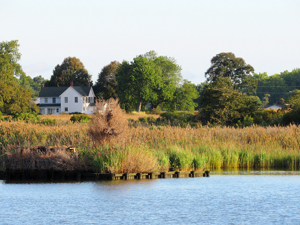
A critical area includes land within 1,000 feet of the tidal waters and wetlands that make up the Chesapeake Bay and its tributaries. State-adopted critical area criteria and the local critical area programs serve as guides that govern all development and land-disturbing activities in the area — whether a homeowner is clearing trees, removing vegetation, or building a shed or pool.
The critical area doesn’t physically alter a person’s property; it’s a line on a map.
The changes come as a result of a state law passed in 2008. House Bill 1253 was enacted in 2008 to update the critical area boundaries, which had not been updated since being established in the 1980s using 1972 paper maps. The legislation directed the Department of Natural Resources to prepare a statewide base map that includes a state-determined shoreline and landward boundary of tidal wetlands and a digitally-generated, georeferenced 1,000-foot critical area boundary.
So why is this happening now if the law was passed in 2008? Kate Charbonneau, Critical Area Commission executive director, said two pilot counties were selected and it took “quite some time” because the process is data-intense.
“We selected pilot counties: Talbot, which has a lot of rural areas, and Baltimore County, which has a lot more development,” Charbonneau said. “We created a map and had to determine how we design shorelines around piers and open water. All these things came about.”
The Critical Area Commission started by taking historic shoreline and wetland data and comparing it to current aerial imagery, color-infrared imagery (CIR), light detecting and ranging (LIDAR) data, and topographic maps. Limited site visits were performed to verify on-the-ground conditions where tree cover restricted the view of the shoreline or where an analysis of the imagery did not allow for a clear determination. Once maps for Talbot and Baltimore counties were complete, the commission began its county-by-county review.
The first set of working draft maps have been prepared for Anne Arundel County, and public reviews were held at four locations including Riviera Beach Volunteer Fire Company in Pasadena on October 15 and Magothy River Middle School in Arnold on October 16.
Homeowners learned that existing structures and other items on their property are grandfathered and do not have to be removed. Anyone who applies for a building permit in the future will be subject to the state-mandated law for the portion of their property in the critical area.
The changes will not affect flood insurance rates or property taxes.
Department of Natural Resources officials say the resulting critical area maps will provide a uniform, consistent, and seamless product that can be easily updated and accessed by the public. To see an online mapping tool, visit www.webmaps.esrgc.org/cbca/desktop/map. Anyone with additional questions can call the Critical Area Commission at 410-260-3460.
“When you get a letter from government, it can be confusing, so we’re always willing to answer questions,” Charbonneau said.


Comments
No comments on this item Please log in to comment by clicking here